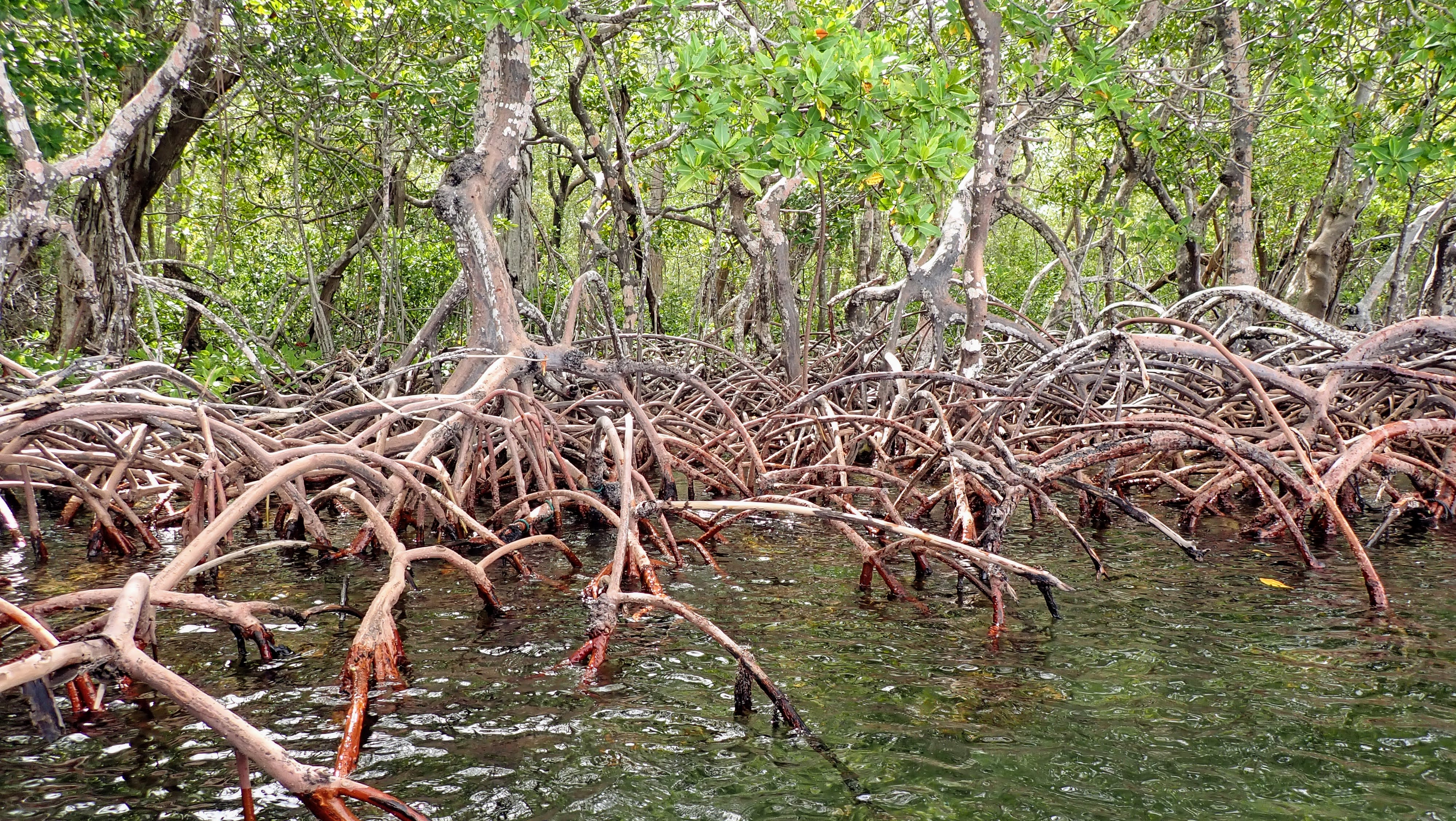
Mangroves are powerful players in fighting climate change, able to store more carbon per unit area than some tropical forests. Above-water roots like these help some mangroves survive in flooded, low-oxygen environments. (Credit: Jonathan Lefcheck/SERC)
by Kristen Goodhue
Mangrove forests try the grit—and grace—of even the most seasoned field ecologist. Flies. Heat. Mazes of trip hazards, from roots and dwarf mangroves jutting aboveground. Suction-cup mud that can pull researchers in up to their thighs.
“If you’re not careful, you can sink,” warned Hannah Morrissette, a postdoc with the Smithsonian Marine Station. Morrissette has explored mangroves in the Dominican Republic and Belize. She’s developed a healthy respect not just for their obstacles, but what they can offer society. “Trying to put a value on these is almost impossible, because of the breadth of their services,” she said.
It’s true: When it comes to protecting coastal economies and drinking up carbon, few ecosystems can compete with mangroves. But few ecosystems make scientists work harder to get the data to prove it.
“I would say, as somebody who’s six foot four, that mangroves are a short person’s game,” said Jonathan Lefcheck, a marine biologist with the Smithsonian Environmental Research Center.
Morrissette and Lefcheck were part of a larger team that journeyed through Belize this September. Dubbed the “Belize Blue Carbon Team,” they joined dozens of Belizean scientists to visit nine mangrove forests in under a month. Their mission: Bolster Belize’s efforts to fight climate change, by uncovering how much carbon its mangrove forests can lock away.
Rising Against The Tide
At first glance, Belize isn’t a country the world would expect to be a leader on fixing climate. The Central American nation is responsible for less than 0.01% of the world’s greenhouse gas emissions. Belize didn’t create the problem. But it’s suffering some of the worst effects.
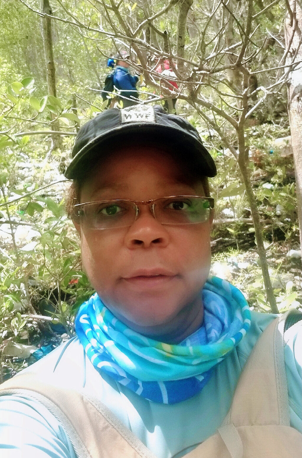
Nadia Bood, a marine scientist with World Wildlife Fund, pauses for a selfie in a mangrove forest. (Credit: Nadia Bood)
“Our economy is strongly tied to the environment, to tourism, to fisheries,” said Nadia Bood, a marine scientist with the World Wildlife Fund’s Mesoamerica office. “Even agriculture, along our coasts. At the same time, most of our coastal area is low-lying, so it’s very susceptible to small changes in sea levels.”
Hurricanes exact their seasonal toll as well. The usual stats—lost lives, lost homes, flooded roads—don’t capture the full cost. Ruined crops mean ruined livelihoods. Polluted sediment that storms wash out to sea can smother coral reefs and seagrasses, jeopardizing tourism and fisheries.
Furthermore, emissions-cutting strategies that wealthier countries rely on—like fuel-efficient cars—aren’t options in Belize.
“We’re getting all of the old cars that don’t pass the emissions tests anymore in the U.S. or in Mexico,” said Ninon Martinez, a marine monitoring specialist with the University of Belize Environmental Research Institute. Even if most Belizeans could access Priuses, she pointed out, they wouldn’t get far. Smaller cars don’t work that well in a nation where even urban centers like Belize City still have dirt roads.
Still, Belize remains determined to lead by example. The country signed the Paris Climate Agreement in 2015, along with nearly 200 other nations. As part of that agreement, they committed to adopting climate mitigation measures, called “Nationally Determined Contributions” or NDCs for short.
And Belize has one gem that’s making the world take notice: Mangroves.
Mangroves—semi-aquatic trees that grow thick along tropical coasts—are masters at storing carbon. Some estimates peg them as up to four times as good per hectare as other tropical forests. They’re a key part of Belize’s climate change strategy. Belize already has nearly 13,000 hectares of mangroves under federal protection. By 2030, they aim to protect 12,000 more hectares, and restore at least another 4,000 hectares.
But for most Belizeans on the coast, storing carbon is just one more perk to an ecosystem they’re already determined to protect.
“Fishermen know the mangroves are important for fisheries,” Martinez said. “People in coastal communities, every single community we visited, said, the mangroves are protecting our shoreline. We need to leave it there. And they want to help with preserving them.”
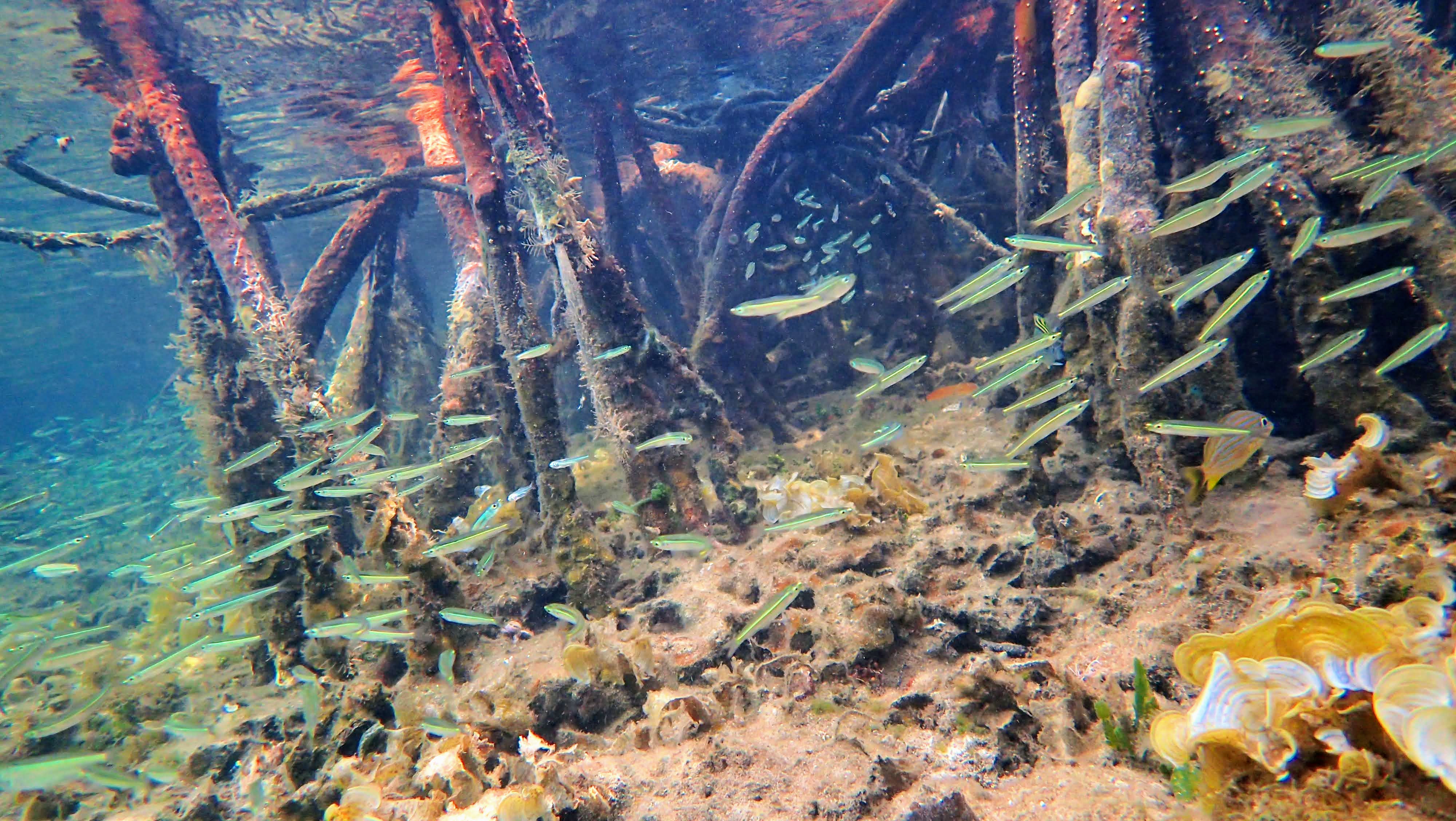
Swarms of fish dart among mangrove roots, which provide valuable underwater habitat and sustain the local economy. (Credit: Jonathan Lefcheck/SERC)
A Month in the Mangroves
The Belize government knew it was sitting on a treasure trove of “blue carbon”—carbon mangroves and other aquatic ecosystems store. But for their climate reports, they needed more accurate national estimates. Right now, the best option is a single estimate that covers all Central America: 949 metric tons per hectare.
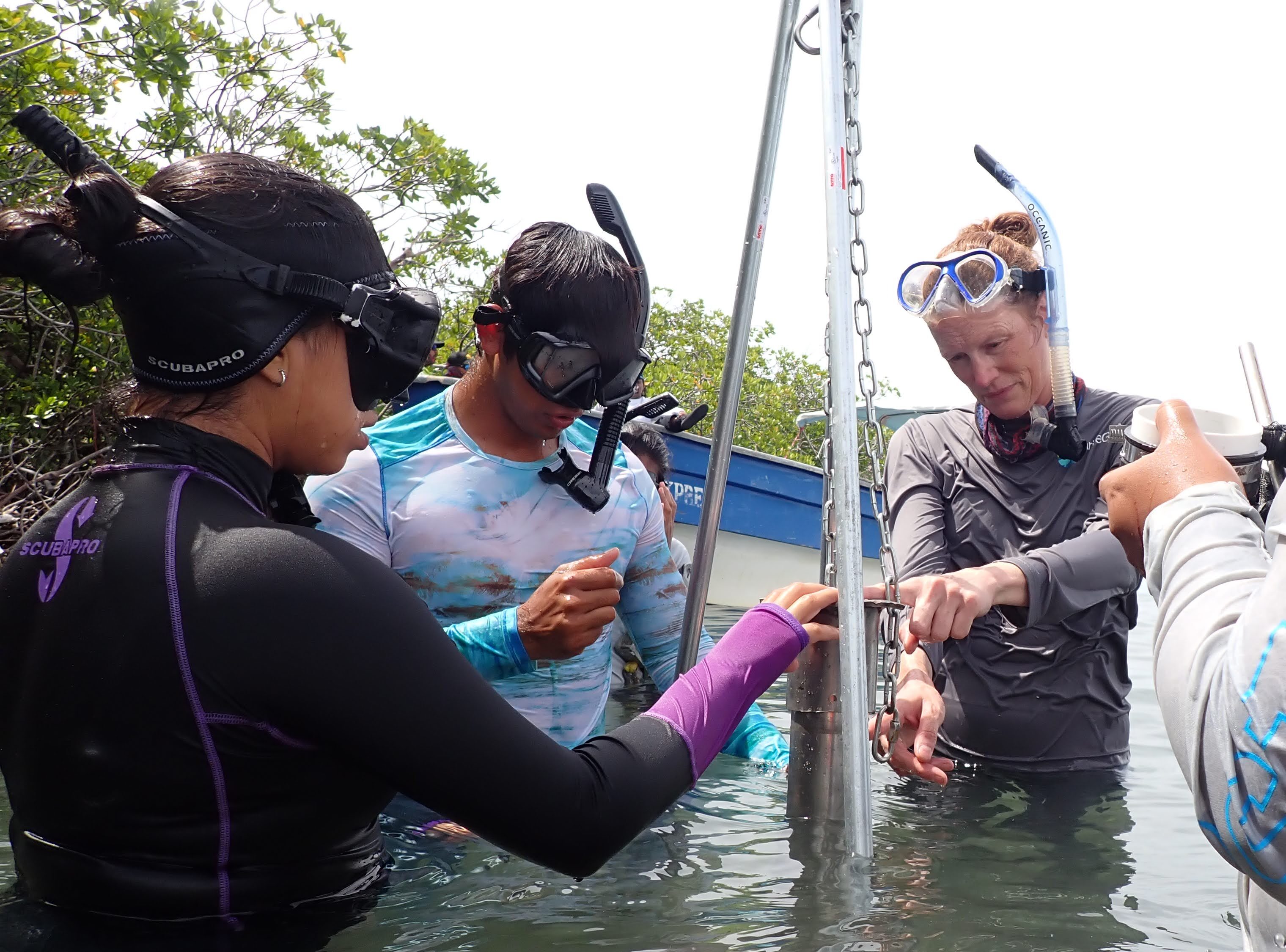
Left to right: Ninon Martinez and Galento Galvez of the University of Belize take a soil core with Lisa Beers of Silvestrum Climate Associates and an unidentified scientist off-camera. (Credit: Jonathan Lefcheck/SERC)
“The in-country estimates are really important,” said Steve Canty, a biologist with the National Museum of Natural History and lead principal investigator for the Smithsonian side of the project. “What the team found out is, mangroves that were only 100 meters away from each other, the sediments, the conditions, were really different….Had we used regional or global estimates, we’re probably going to be quite inaccurate.”
The project started when The Pew Charitable Trusts, as part of its effort to help countries include mangroves and other coastal wetlands in their national climate plans, began working with the government of Belize and the World Wildlife Fund. That’s when the Smithsonian got involved, along with Silvestrum Climate Associates. They teamed up with the University of Belize Environmental Research Institute, along with several other Belize agencies and NGOs, for a month-long mangrove survey in Belize.
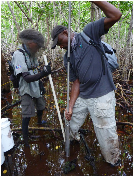
Scientists Gilbert Andrews (right) and Tre Mckoy take a soil sample from a mangrove forest. (Credit: Hannah Morrissette/Smithsonian Marine Station)
“Belize’s commitment to protect mangroves through its NDCs is a clear example of how countries can include nature-based solutions in the fight against climate change,” said Stacy Baez, a Pew officer who specializes in wetland and mangrove protection.
Originally, the scientists planned to make the trip in spring 2021. But they decided to wait until September, so as many members as possible could get COVID vaccines. Even then they took extra safety measures. Each member had to show a negative COVID test within 48 hours of beginning field work. They also took daily temperature tests.
“We wanted to make sure nothing could stop us once we were there, so we had to take every precaution,” said Morrissette.
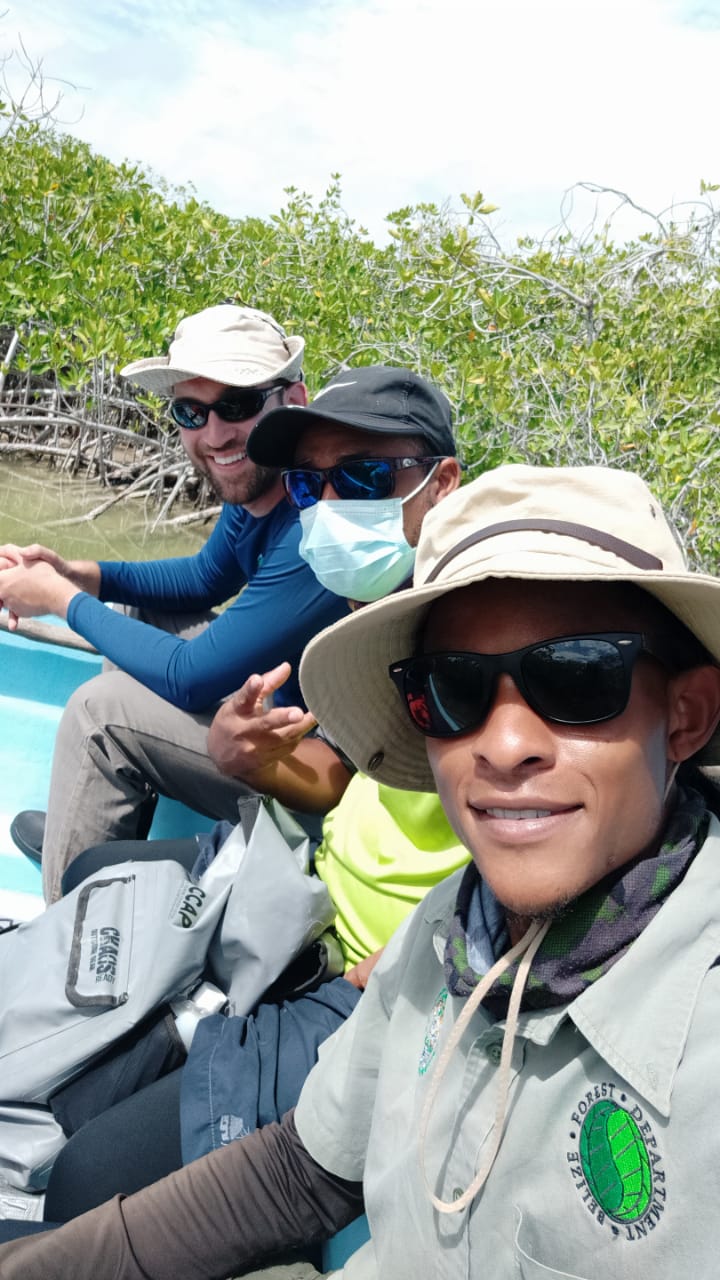
Front to back: Tre Mckoy of the Belize Forestry Department, Kent Garbutt of the Belize Coastal Zone Management Authority & Institute, and Jonathan Lefcheck of the Smithsonian Environmental Research Center (Credit: Tre Mckoy)
The team began their surveys in Belize City. From there, they travelled north and then south of the city, covering nine forests. The Smithsonian and Silvestrum helped train Belizean scientists to collect mangrove samples for carbon analysis. Local experts like Martinez and Bood organized all the in-country logistics, including housing, research permits and engaging the various partners involved. They also helped the team adapt when storms kept them from their originally planned sites.
“They knew these systems,” Lefcheck said. “Sometimes the weather was a little bit dicey. So we had to on the fly say, okay, well we can’t make it there today because it’s just too far and we’re worried about storms. But we could maybe hit up this site that’s closer.”
Most of mangroves’ carbon wealth isn’t in the trees, but in the roots and soil. According to the regional estimate for Central America, over 90% of mangroves’ carbon storage is belowground. So besides tree measurements, the team took 12 soil cores from every site. From each core, they pulled several samples at various depths.
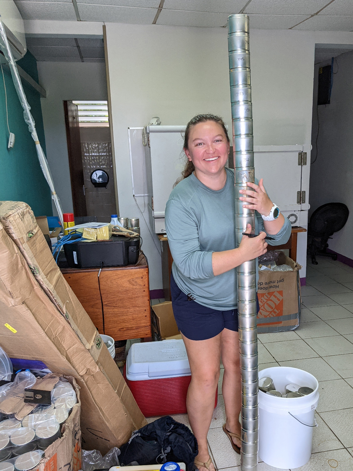
Hannah Morrissette poses with a stack of soil samples from the mangroves, some of the roughly 1,300 she’s analyzing for carbon stocks from the Belize Blue Carbon trip. (Credit: Jonathan Lefcheck/SERC)
Those soil samples—roughly 1,300 total—are in a lab at the Smithsonian Environmental Research Center with Morrissette now. It’s her job to analyze them for blue carbon, so Belize can incorporate that data into its next climate change report in 2025.
Meanwhile, back in Belize, Martinez and Bood are brainstorming next steps. Martinez hopes local scientists can expand the mangrove surveys, to capture even more of the country’s mangrove diversity. As one of its climate action items, the country aims to complete an on-site assessment of mangroves’ belowground carbon stocks by 2022. Bood is working on engaging the government and private landowners in conserving nature to fight climate change.
“We are only one country. We can only do so much,” said Bood. Even if every country acted now, she said, Belize would still feel the impacts. “But if we act at a local level to try and protect and enhance these ecosystems that currently exist, they could at least buy us time in terms of having to protect our life, our livelihood, our infrastructure, our homes, our economies.”
In addition to the organizations mentioned in the article, the following organizations also participated in the Belize Blue Carbon project: The Belize Forestry Department, Belize Fisheries Department, the Coastal Zone Management Authority & Institute in Belize, the National Climate Change Office in Belize, the Toledo Institute for Development and Environment, the Turneffe Atoll Sustainability Association, the Corozal Sustainable Future Initiative, the Sarteneja Alliance for Conservation and Development, and the Belize Southern Environmental Association.

