By Joe Dawson
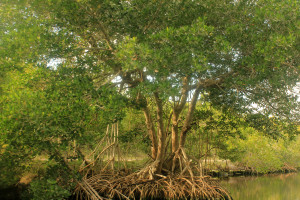
A stand of mangrove trees in Florida (Credit: Yinan Chen under CC0/Public Domain license)
With their tall, arching roots reaching down like hands into the water, mangrove trees can look downright creepy. And yet they’re critical species for the environment—and humans—on five different continents: They can create their own islands, provide one-of-a-kind habitats for wetland creatures, and store carbon like mad. They also protect shorelines from storms and tsunamis. Unfortunately, and perhaps unsurprisingly, humans are destroying them at a rate that may doom them within a century.
Aquaculture, urban development, tourism, and agriculture are threatening mangrove habitats around the world. Like many natural ecosystems, they are being cut down and destroyed to make way for human endeavors, and human pollution is taking its toll on their growth at the same time. But even as their total acreage decreases, they’re gaining ground in some places. Climate change is causing mangroves to move beyond their tropical habitats and take over neighboring salt marshes, but not always predictably. In North America and South Africa, they are moving toward the poles, while in Australia they are expanding along an east-west axis. All these disappearances and migrations present a riddle for scientists—but one they will need to solve to prevent habitat loss and prepare for a warmer future.
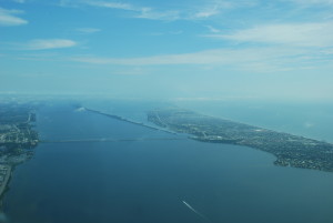
The Indian River Lagoon, in 2006. (Credit: Candy Feller/SERC)
University of Connecticut scientist John Hamilton, along with SERC scientists Richard Osman and Ilka Feller, used a computer model to predict the spread of mangrove trees and the animal species that live on them in the Indian River Lagoon, on the east coast of Florida. Their findings appear in the May issue of Hydrobiologia. Mangrove seedlings spread on water, floating on currents until they find a new place to grow. The Indian River Lagoon is full of red, black and white mangrove trees these days, but the researchers modeled the area as it might have been in the past, starting with only a few small mangrove groups, in order to test how mangroves spread to a new environment.
This research can provide “an idea of how rapidly habitats might be moving up the coast as climate changes,” Osman said.
Historical accounts and measurements have allowed researchers to compare mangrove coverage and spread over the past two centuries in the lagoon, and the results of the model compare well with the historical spread rate.
“We’re in the right ballpark in terms of spread,” Osman said.
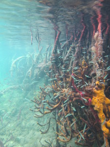
Mangroves are habitats for a great number of fish, crustaceans, and invertebrates. (Credit: John Parker/SERC)
The team gathered three pieces of valuable intel from the model. First, local water currents greatly influence how quickly all three mangrove species spread. According to previous research on mangrove movement, mangroves seem to be creeping up the coast of Florida at about 2 kilometers per year overall, but the model of the Indian River Lagoon showed a rate of just 1 kilometer per year.
Secondly, in the experiment’s model, mangroves also showed that they could establish themselves in a new place rather quickly from small populations.
“I was surprised at how rapidly things spread, at least initially,” Osman said. This means that mangrove trees could take over a new area quickly, or could bounce back from a disturbance like a storm or a harsh winter. “It would slow them down a bit, but they would come back,” he said.
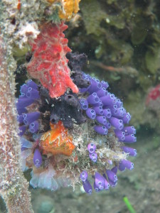
Ascidians (purple) and sponges (red, orange) take advantage of mangrove roots by growing extensive colonies. (Credit: John Parker/SERC).
Lastly, because of their unique ability to make their homes on shorelines, mangrove roots provide a valuable resource for aquatic animals: something hard to live on. Fish, crabs, and many aquatic species live around mangrove roots. This is one reason they are so valuable, ecologically speaking. Mangrove-loving barnacles, ascidians (invertebrate, tube-like filter feeders), and bryozoans (also invertebrate filter feeders, with tentacle-like appendages) live their adult lives attached to roots, and these were all modeled in the study. The researchers found that animals that generally rely on mangroves could spread via manmade docks, jetties, and bulkheads too, but not as well as they did on the tree roots.
While this study focused on one body of water—the Indian River Lagoon—and its mangroves and animals, the model’s strength is its flexibility. Because the team created the model using a detailed map of the water currents, other scientists can apply it to any body of water with a similar map and satellite images. It doesn’t even need to be applied strictly to mangroves. It could work for modeling any water-dispersed species and its spread. And if research reveals new data about a particular tree species or one of its related animals, the model can be updated to give a more realistic picture.
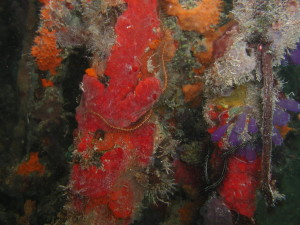
Sponges (red objects and most of the orange masses) and ascidians (purple tube-like structures) were both modeled in this computer simulation. (Credit: Richard Osman/SERC)
A 2010 report by the United Nations Environment Programme called mangrove forests “one of the most threatened ecosystems on the planet”. At the same time, mangrove forests may help protect us from threats like storm surges and rising sea levels. Armed with knowledge from this model and other research, we may be able to protect those forests that will protect us.

