by Sarah Hansen

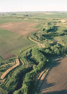
A buffer on the Chester River in Queen Anne’s County, MD protects the river from nitrogen pollution. (USDA)
Nitrogen pollution in the Chesapeake Bay became a serious concern in the mid-20th century after the advent of nitrogen-rich chemical fertilizers. Bay restoration efforts have reduced nitrogen pollution somewhat, but achieving healthy nitrogen levels in the Bay is still a long way off. Croplands remain an important source of the nitrogen that pollutes Chesapeake Bay.
Don Weller, senior scientist at the Smithsonian Environmental Research Center, and his colleague Matthew Baker, associate professor of geography and environmental systems at the University of Maryland, Baltimore County, report in a new study that just over half the nitrogen from croplands might never reach the Bay—if all crop fields were protected by streamside forests and wetlands.
People have been trying to reduce pollution from nitrogen and other nutrients for years. In 2010, the EPA prescribed a “pollution diet” for the Bay that limits the Total Maximum Daily Load (TMDL) of pollutants allowed, leaving local and state governments to decide how to meet the requirements. “They’re all scrambling to figure out how to do that,” said Weller.
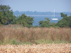
Restoring riparian buffers has been the most popular tactic. Riparian buffers are regions of wetland and forest between cropland and a waterway. These buffer zones prevent some of the nitrogen from reaching the water. But no scientist had ever done a large-scale study to determine how well they actually work. Smaller studies had provided mixed results.
Enter Weller and Baker. “No one had ever estimated the effects of buffers across a watershed as big as the Chesapeake Bay using an empirical model,” said Weller. “So that’s a first.”
But what’s wrong with a little extra nitrogen? After all, it makes up more than three-fourths of the air we breathe and is essential for building proteins. But in the Chesapeake Bay, excessive nitrogen provides extra nutrients for algae, resulting in algal blooms. Algae block light from reaching the bottom of the Bay, making it hard for submerged aquatic vegetation (SAV) to grow. SAV provides food and habitat for aquatic animals. Then, when the algae decompose on the bottom, oxygen levels plummet, creating a “dead zone” with little or no oxygen for animals to breathe. Clearly, nitrogen isn’t always so friendly.
Weller and Baker’s model looked at almost 2000 subunits that together comprise the entire Chesapeake Bay watershed. They used digital imagery techniques that identify buffer zones and cropland in the region. Weller and Baker also used topographical data to determine which direction water would flow from a crop field to water, and if it would pass through a buffer on the way.
Their new, sophisticated model determined that out of 203 million pounds of nitrogen released by croplands, one-fifth was absorbed by buffers, but only two-fifths of croplands had buffers. If the remaining croplands in the watershed had buffers restored, at most almost an additional one-third of the nitrogen leaving croplands could be removed.
But not all buffers are created equal. There were big differences in the efficiency of buffers in different geographic regions. Coastal plain regions had the most efficient buffers and also the most total cropland, whereas the Appalachian mountain regions had the least effective buffers.
“Regional differences affect the way that farmers work their land, their need to use different amounts and types of fertilizer and when,” explained Baker. To work, any restoration strategy will need to take these differences into account. Some regions will require other management practices to reduce the nitrogen not intercepted by riparian buffers. Alternative methods include conscientious use of cover crops during the off-season. Also, farmers should be careful to only use the amount of fertilizer necessary for their particular situation.
Protecting our watershed is crucial. Thanks to Weller and Baker, we now have a thorough, accurate model for estimating pollution reduction by riparian buffers and predicting the possible effectiveness of additional buffers – all while allowing our farmers to continue putting food on tables throughout the mid-Atlantic.
The study was published in the June issue of the Journal of the American Water Resources Association. A full copy is available here: http://onlinelibrary.wiley.com/doi/10.1111/jawr.12207/abstract


