add_filter('bloginfo_url', function($output, $property){ error_log("====property=" . $property); return ($property == 'pingback_url') ? null : $output; }, 11, 2);
 

Extreme Weather

...now browsing by category


Land Hurricanes: The Science Behind the Derecho

Tuesday, July 3rd, 2012

by Kristen Minogue

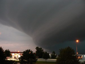
Derecho storm front over Nebraska in August 2007. (MONGO)

To say the tempests of June 29 took the U.S. by surprise would be an understatement. Near Annapolis, the storms jumped from a mild 10 miles per hour to 54 miles per hour in just five minutes. In other places 70- and 80-mile per hour winds tore through hulking trees and power lines. And yet the most violent part of the storm lasted less than half an hour.

“It all happened in a matter of minutes….I’ve never seen anything like it,” said ecologist Pat Neale, who tracked the wind speeds on SERC’s meteorological tower.

How could something so quick cause so much damage? And how would a storm like that form in the first place?

Click to continue »

Share

Snowmageddon vs. Caribbean Creep

Monday, January 9th, 2012

by Monaca Noble

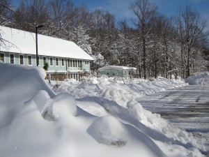
SERC's Green Village during Snowmageddon February 2010 (Stephen Sanford)

Remember Snowmageddon 2010, the east coast storms that dumped up to three feet of snow over the mid-Atlantic? The February snowstorm was the largest in the region in nearly 90 years, resulting in the heaviest snowfall on record for Delaware (26.5 inches) and the third heaviest snowfall in Baltimore (24.8 inches). The storm made a big impression on Dr. João Canning-Clode and other scientists at the Smithsonian Environmental Research Center, who began to wonder if the storm, and the December/January cold snap that preceded it, would lead to the deaths and potential disappearance of marine invaders from southern climates.
Click to continue »

Share

Hurricanes, Snakeheads and Dead Zones: What 2011 Weather Meant for the Chesapeake

Wednesday, October 5th, 2011

by Kristen Minogue

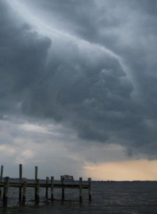
Credit: NOAA Photo Library

Let’s face it, the East Coast has had an incredibly bizarre year. In 2011 so far, we’ve seen the coldest January on record, the hottest month on record (July), a hurricane, a tropical storm and an earthquake (we’re not even going to touch the last one – we’ll leave that to our colleagues at Natural History). And to top it off, August and September drenched us with uncharacteristically high rainfall. While SERC tends to focus on the long-term picture rather than brief snapshots, this year has prompted more than a few raised eyebrows among our scientists. What does it mean for the environment? What does it mean for Chesapeake Bay? And can any of it be linked to climate change?

Click to continue »

Share
Shorelines