by Nancy Shipley
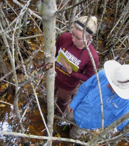
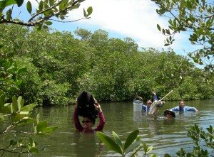
Technician Lorae Simpson and intern Jake Bodart deep in the mangroves, assessing vegetation cover and substrate color. (Mayda Nathan)
It sometimes seems crazy to be climbing through mangrove stands and wading through large ponds to collect our data, but the sites we explore are chosen for a reason. That reason is two-fold: One, to ground truth satellite imagery so we can map historic and current mangrove distributions. Two, to document the plant communities in places dominated by mangroves, in places where mangrove encroachment is occurring, and in places where mangroves have not yet arrived.
By using satellite imagery from years past, we hope to determine how far mangrove communities have spread in the last few decades. To do this we have to first understand what individual plant species comprise the large areas of vegetation that we can see from the satellites.
That is where we come in, climbing through mangroves.


