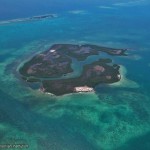
Aerial view of Mangal Cay in the western Caribbean – just one of many mangrove havens Ilka Feller has explored.
As global temperatures rise, mangrove forests from the southeastern US are pushing farther north. Scientists don’t know how long, how fast, or what the exact consequences will be, but images from NASA satellites – and $1.3 million – will help them find out.
Ilka Feller, senior ecologist at the Smithsonian Environmental Research Center, will lead the effort to track more than 100 miles of Florida mangrove forests encroaching on their northern neighbors, the salt marshes. Feller has been studying mangroves for almost 20 years, keeping tabs on their progress in Florida, Panama, Belize and Australia. The new grant is one of 15 NASA-sponsored projects that will combine satellite data with field work to give scientists a bird’s-eye view of climate change.

Cold temperatures usually restrict mangroves to the tropics and subtropics, but a warming climate has empowered them to expand northward.
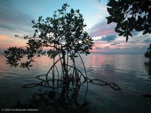
Mangrove trees thrive in the tropics and subtropics near the ocean. Their roots often appear above ground, and they can grow to enormous heights, in some places up to 45 meters. They start reproducing at a young age, so they can establish themselves in a community very quickly. However, they’re also very sensitive to cold, which in the past has held them in check.
Read more: With fewer hard frosts, tropical mangroves push north
Only a couple degrees of latitude north live the salt marshes, ecosystems populated by small, soft-stemmed plants that prefer a more temperate climate. These plants only sprout up in warm weather and burrow underground when it becomes cold. Because the two types of plants have such different structures, a mass migration of mangroves northward could impact everything in the ecosystem, including carbon sequestration, nutrient flow and the kinds of organisms can survive there.
With less of a chill to hold back the mangroves, an overlap zone 120 miles long has emerged where they have invaded salt marsh territory. It stretches from Cocoa Beach in the south to St. Augustine in the north. This is where Feller and her team will base their study. For the next four years, they plan to analyze 21 different sites in the overlap zone. They hope to find out how long the invasion has been going on, how fast it’s happening and – most importantly – how it’s affecting the ecosystems where salt marshes once dominated.
In addition to SERC scientists John Parker and Richard Osman, Feller will be joined by Dan Gruner of the University of Maryland and Wilfrid Rodriguez of the University of Rhode Island.
Explore mangroves of the Caribbean and their wildlife >>
See first-hand stories from scientists working in the mangroves >>
-by Kristen Minogue


This project is fascinating. I love the blogs too. Keep up the good work and please let us know when papers are published.