
by Shelby Brown
The Smithsonian Environmental Research Center (SERC) and the City College of New York (CCNY) have joined forces to launch a new participatory science project in the Chesapeake Bay. Chesapeake Water Watch is a collaborative effort aimed at filling in the gaps of traditional water monitoring techniques by using remote sensing and community involvement.
The Chesapeake Bay is one of the largest estuaries in the world and is home to over 3,600 species of plants and animals. However, the Bay faces numerous challenges, including nutrient pollution, sedimentation, and climate change. To ensure the health of the Bay, it is essential to have accurate and comprehensive data on water quality.
Traditional water monitoring techniques involve deploying expensive equipment at fixed locations, which can be limited in coverage and scope. Chesapeake Water Watch takes a different approach by leveraging the power of remote sensing and community involvement to gather data from a wider range of locations.
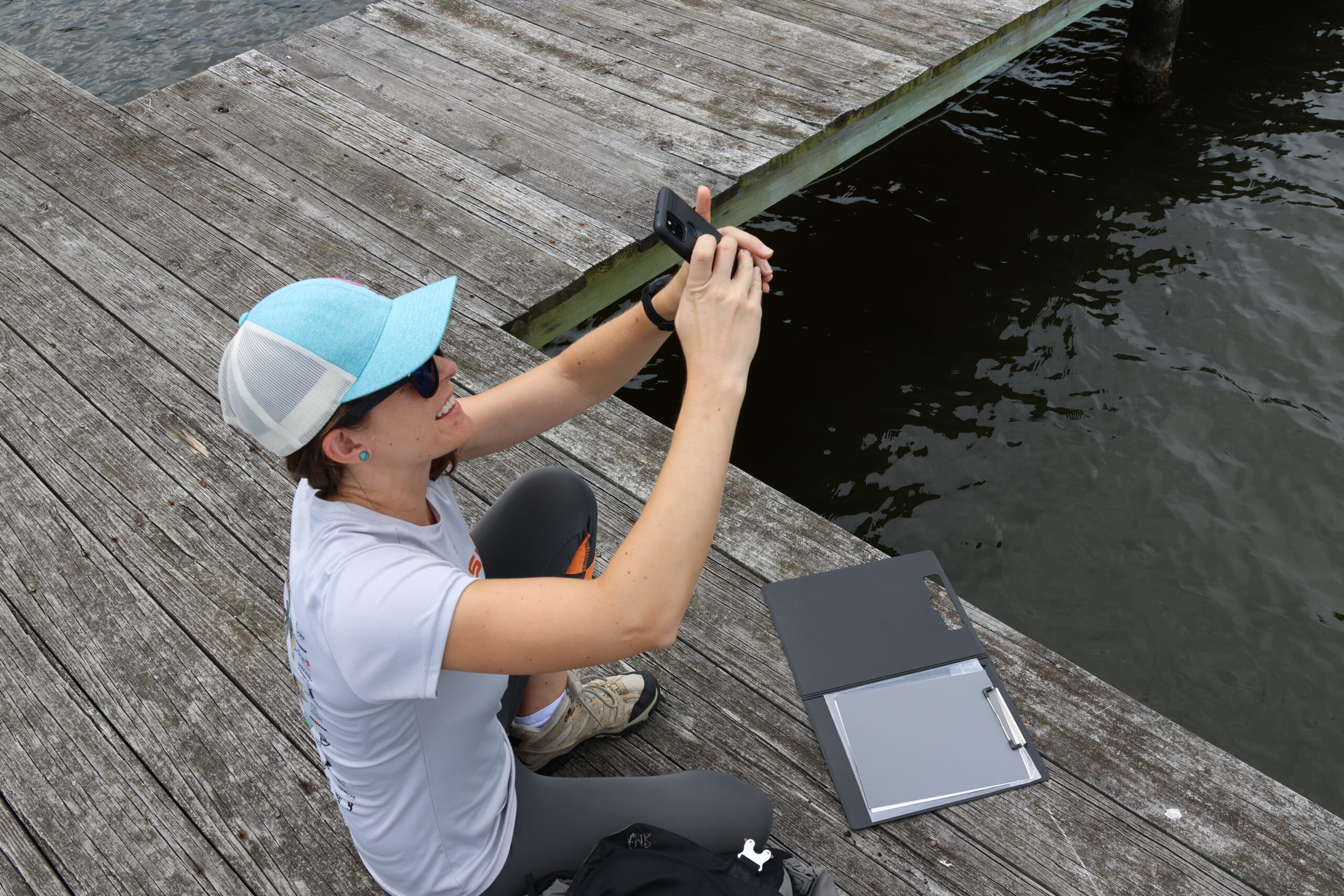
To achieve this, Chesapeake Water Watch is partnering with Riverkeepers and individuals in the community to collect data with simple-to-use scientific equipment and a free smartphone application – HydroColor. The project aims to engage the community in the scientific process, educate them about the importance of the Chesapeake Bay and provide them with tools to contribute to its conservation.
The collected data will be used to optimize NASA’s satellite algorithms and essentially help “train” the satellites to accurately monitor the Bay. This process of cross-referencing data taken on the ground with the satellite imagery is referred to as ground-truthing. By combining data collected by people on the ground with satellite imagery, they hope to create a more accurate and comprehensive picture of the health of the Bay particularly in less monitored rivers and tributaries.
“This project is an exciting new approach to water quality monitoring in the Chesapeake Bay,” says Shelby Brown, Project Specialist for Chesapeake Water Watch. “By engaging the community and using cutting-edge technology, we can gather data from a wider range of locations and provide more comprehensive information on the Bay’s health.”
Chesapeake Water Watch is open to anyone interested in participating. No prior scientific knowledge is required, and the equipment and training will be provided free of charge. Participants will receive feedback on the data they collect and have the opportunity to engage with scientists working on the project.

“This project is a great example of how science can be more accessible and inclusive,” says Brown. “By empowering people with the tools to collect data, we can deepen the connection Chesapeake Bay residents have with their home while simultaneously improving satellites’ capabilities to monitor coastal environments.”
Chesapeake Water Watch is an important step towards creating a more sustainable future for the Chesapeake Bay. By combining the power of community involvement with cutting-edge technology, we can gather more accurate and comprehensive data on the Bay’s health, leading to better informed conservation efforts and policy decisions.
For more information on Chesapeake Water Watch and how to get involved, visit the Chesapeake Water Watch website.
Curious about other SERC citizen science projects? Learn more here:
“Orchids In Classrooms” Turns Sixth-Graders Into Citizen Scientists
Invader ID Volunteers Are Deploying Tiles in Chesapeake Bay
Citizen Science: How to Hunt for Crabs (And Their Parasites)
