
by Kristen Minogue
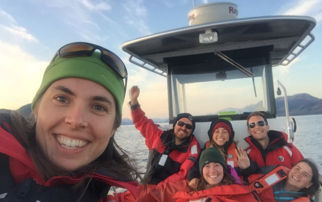
Margot Hessing-Lewis and the Nearshore Tech Team of the Hakai Institute, British Columbia, one of the newest MarineGEO sites on the Pacific. (Photo: Margot Hessing-Lewis, Hakai Insititute)
Imagine gazing into the ocean off Maryland knowing what life is under the waves, what’s driving the food web, and how healthy the water is. Then, imagine being able to discover the same thing for another coast halfway around the world. That vision—of a network vast enough to take the pulse of coastal waters worldwide—began becoming a reality at the Smithsonian in 2012. It’s called the Marine Global Earth Observatory, or MarineGEO.
Back in 2012, it had only four sites, known as the “Tennenbaum Marine Observatories Network” after Michael and Suzanne Tennenbaum, whose donation jumpstarted the network. Those original four were all on the Atlantic: The Smithsonian Environmental Research Center (SERC) in Chesapeake Bay, the Smithsonian Marine Station in Florida, Carrie Bow Cay in Belize, and the Smithsonian Tropical Research Institute in Panama. Today, MarineGEO has nine sites, with three on the Pacific and memoranda of understanding for sites at Texas A&M University and the University of Hong Kong. And there is one more Pacific site still to come.
“The MarineGEO aspiration has always been to extend around the world … The ocean is connected everywhere,” said Emmett Duffy, MarineGEO’s director based out of SERC.
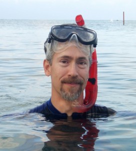
MarineGEO director Emmett Duffy (Photo: College of William and Mary)
San Francisco State University’s Romberg Tiburon Center—a long-time partner of SERC—was the first non-Smithsonian site to sign on in 2013. The Hawai’i Institute of Marine Biology, part of the University of Hawai‘i at Mānoa, joined a year later. British Columbia’s Hakai Institute began gearing up this summer, and the University of Washington’s Friday Harbor Laboratories will soon follow.
Entering the Pacific was critical. “The Atlantic and the Pacific are two different oceans,” said Ross Whippo, MarineGEO’s head technician. “You’d be hard pressed to come up with some result in a specific place in the Atlantic Ocean with some observation or experiment and expect it to hold true everywhere around the world.”
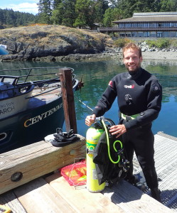
MarineGEO technician Ross Whippo prepares for a dive at Friday Harbor Laboratories, in Washington State. (Photo: Pema Kitaeff)
Some differences are stark. The Atlantic coast of the United States is riddled with bays, whose floors are covered in sand and seagrass. The Pacific coast, by contrast, is generally colder and rockier. Kelp forests—towers of brown algae sheltering thousands of marine species—dominate much of the underwater landscape. Nutrients, instead of streaming off land, upwell from the deep ocean. And while low-oxygen “dead zones” come in day-night cycles in the Atlantic’s shallow waters, Pacific waters more often face long-term oxygen depletion.
How do researchers create a modus operandi that can monitor both coasts—and sites beyond North America? While each MarineGEO site can conduct its own experiments, all sites are doing four surveys: water quality; habitat mapping; measuring processes, like feeding and predation; and surveying biodiversity around “foundation species” like seagrasses, oysters, corals and kelp.
Momentum is building with the addition of Texas A&M and the University of Hong Kong. “The idea of MarineGEO seems to be catching on,” said Duffy. “People are very interested in working together in answering big questions.” The biggest question, the one that originally inspired MarineGEO, is biodiversity.
“The core of MarineGEO is biodiversity,” Whippo said. “That’s what MarineGEO is really all about. And I think it will be really exciting to see, as the network grows and spreads across the globe, to see how relationships between biodiversity and human impacts change.”
THE PIONEER STATES
Romberg Tiburon Center: San Francisco State University
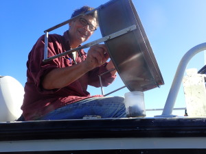
SERC marine biologist Greg Ruiz sifts sediment in San Francisco. (Credit: Ross Whippo/SERC)
The marine station of San Francisco State University, the Romberg Tiburon Center has been a second home for SERC researchers for over a decade before becoming MarineGEO’s first non-Smithsonian site in 2013. This summer, scientists surveyed natural and restored eelgrass, detected bat rays and leopard sharks with sonar video, and tested “squid pops,” small sticks with dried squid meat planted underwater to study predators. With a major city nearby, San Francisco Bay is shaped by many human impacts. But lead scientist Kathy Boyer sees MarineGEO as a chance to track their conservation and restoration projects and discover keys to success.
Kane’ohe Bay: University of Hawai’i at Mānoa
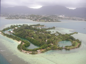
Coconut Island, Hawai’i (Credit: Forest & Kim Starr)
MarineGEO’s Hawaiian outpost is headquartered on Kane‘ohe Bay’s Coconut Island, a small, 28-acre island off of Oahu. Mary Hagedorn, a Smithsonian Conservation Biology Institute senior scientist, has teamed up with scientists of the Hawai‘i Institute of Marine Biology, a field station of the University of Hawai‘i at Mānoa. Next June, the team will survey the biodiversity of the island’s coral reefs and the impact of humans. Additionally, MarineGEO-Hawai‘i is training native Hawaiian high school students in natural sciences and biodiversity monitoring, and merging science and culture by incorporating the ecological knowledge of Hawai‘i’s indigenous groups.
Calvert Island: Hakai Institute, British Columbia

A diver with the Hakai Institute examines red sea urchins. (Credit: Grant Callegari)
Hakai Institute’s Calvert Island is at least a two-hour boat ride from Vancouver Island—seven, in troubled waters. Hakai’s MarineGEO team focuses on four marine habitats: kelp, seagrass, soft sediments and rocky intertidal zones. They’re mapping them with help from drones (a.k.a. “unmanned aerial systems”) and partnering with local First Nations groups to better understand these vital ecosystems. Monitoring will be critical if an oil or natural gas accident took place, according to lead scientist Margot-Hessing Lewis. By comparing before and after data, “we’d be able to get a read on the calamity,” she said.
Friday Harbor Laboratories: University of Washington
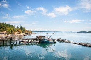
Friday Harbor Laboratories dock (Credit: Kathleen Ballard)
Friday Harbor Laboratories sits on San Juan Island, roughly 80 miles northwest of Seattle. Salmon restoration is a major issue, partly because orca whales that frequent the island need salmon for food. “The orcas are starving because they live on Chinook salmon,” said director Billie Swalla. Surface conditions also can change sharply in enclosed waters. Friday Harbor is preparing to install instruments to measure ocean acidification and other environmental factors, making it a natural fit for MarineGEO. Though a formal agreement is pending, Swalla said she hopes the entire College of the Environment at the University of Washington will join.
Photo of Coconut Island used by permission of Forest & Kim Starr
