
By Emily Li, science writing intern
You might have heard of The Giving Tree, a children’s picture book by Shel Silverstein about a boy and a tree. As the boy grew, he began to want more from the tree, and the tree happily gave and gave and gave: her apples, her branches, and even her trunk. While Silverstein’s heartbreaking story was a fiction, the plot is happening in wetlands around the world—and this time, it’s for real. Marshes improve water quality, mitigate hurricane damage, sequester atmospheric carbon, and serve as ideal habitats and nurseries for wildlife. In return, as sea levels rise, they’re in line to be the first casualties.
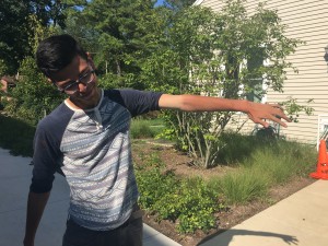
SERC intern Jefferson Riera shows off his sunburn after a day in the field. (Photo: Emily Li/SERC)
That said, marshes are hardly a serene paradise. To Smithsonian Environmental Research Center intern Jefferson Riera, wetlands are ruined shoes caked in mud. Wetlands are wasp stings on his lips. Wetlands are spider webs of scratches from marsh vegetation. Wetlands are sunburns so severe his skin doesn’t match itself anymore.
And yet, he knows that they’re worth protecting. That’s why he, and the rest of SERC’s Ecological Modeling Lab, are working to develop a baseline understanding of local marsh elevation to educate policymakers on the state of wetlands—before their fates are sealed by the sea.
The front lines of sea level rise
Luckily, SERC is well equipped to study how climate change might affect wetlands thanks to its Global Change Research Wetland (GCREW), toted as the “wetland of the future.” There, SERC scientists are glimpsing into the year 2100 by injecting carbon dioxide into the marsh’s air and heating its soil. But they don’t know its exact elevation or what it will look like in the future. That’s where modeling comes in.
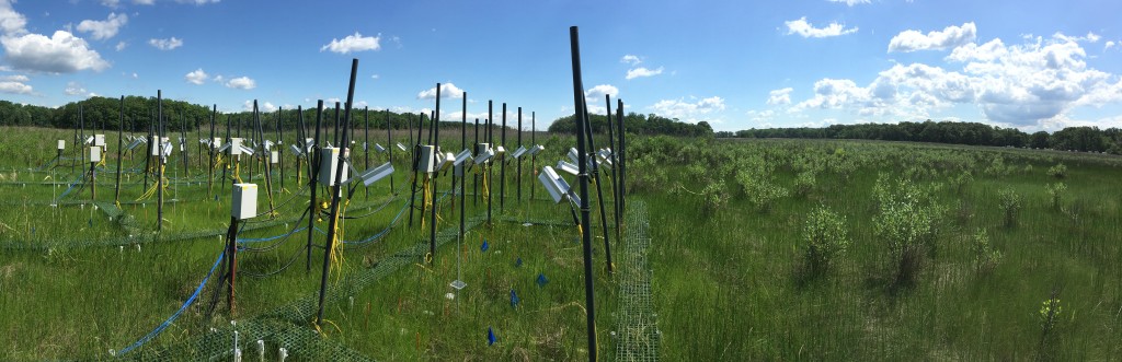
A network of infrared lamps and underground cables heat global warming plots in the Global Change Research Wetland. (Photo: Emily Li/SERC)
Riera and his lab aren’t the first to take a crack at modeling wetland elevation. LiDAR data (Light Detection and Ranging) uses a laser scanner attached to an airplane to record the reflection of energy from the ground, which can create detailed elevation models. But it’s not without problems. The laser pulses often don’t reach the soil because of vegetation, creating distorted models that underestimate sea level rise because they overestimate marsh elevation levels. In addition, Anne Arundel County conducted the most recent LiDAR survey at SERC back in 2011, putting the scientists in need of more up-to-date data.
“A lot can happen in five years,” said Riera. “People work there all the time… people see how often it’s inundated just based on the daily tidal cycle, and they don’t match. The observational and the quantitative don’t match.”
Doing the math—and the manual labor
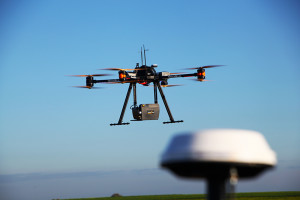
Airborne LiDAR survey being performed in Belgium, November 2015 (Photo: Cargayrak)
To address this disparity, Riera and his lab are correcting the LiDAR data in two ways: 1) full waveform LiDAR correction and 2) vegetation class correction.
The advantage of full waveform LiDAR, a relatively new development in LiDAR technology, is that it records the entire waveform reflection of the laser pulse on its way from the plane to the ground, which should show everything it encounters on the way down. In contrast, regular (or “discrete return”) LiDAR only records a few pulses that don’t always accurately capture structural nuances—like differentiating between a mat of marsh grass and the ground. But while full waveform LiDAR has proven to be a valuable tool in statistical modeling, it doesn’t close the gap entirely.
“Models can never be proven right—you can only prove them wrong,” Riera said. “You never know if a model is 100 percent correct. You can always find something that changes a model, you can always add something to the model … That’s what modeling is.”
Full waveform LiDAR data will be flying in soon thanks to the National Ecological Observatory Network, an observation system examining ecological change on a continental scale. Their airborne observation platform collects annual remote sensing data using plane-mounted sensors.
The next step is performing a vegetation class correction. Because they’ve established vegetation to be an issue, the lab is working to account for their elevation. The most accurate way to do this is manually, by measuring the height of all plants inside the 526 GCREW plots the lab mapped.
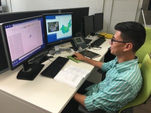
Intern Jefferson Riera analyzes marsh elevation data (Photo: Emily Li/SERC)
Fortunately, the lab isn’t alone. They rely on Real-Time Kinematic (RTK) satellite navigation, a technique used to enhance GPS data to centimeter-level accuracy. But the information was still costly, although Riera believes the data is worth every square inch of sunburn. Already, he’s used their preliminary RTK records to reduce the LiDAR error by 14 centimeters. And even after the scratches and stings heal and his internship ends, Riera plans to continue working on the project. His hope is that the research can be made useful on a global scale, especially for regions vulnerable to sea-level rise.
“Obviously, we want to create a model that would be good for GCREW, but we want to create a model that’s very scalable to all the marshes in the world,” said Riera.
To him, statistical modeling builds a bridge between environmental law and environmental science, because its predictions will allow scientists to use the data in a way that can inform policy. So while he’s helping SERC model marsh elevation, he’s taking steps toward a career in policy at the same time.
“The best policymakers, in my opinion, would be the scientists. They know what’s going to happen,” said Riera. “So having that scientific background and being a policymaker—going into environmental law or environmental policy—I get the best of both worlds.”
Photo of LiDAR survey technology used under Creative Commons license from Cargyrak.
